Frank Drago Area Traffic Management

Thank you for your input.  This consultation is now closed
Background

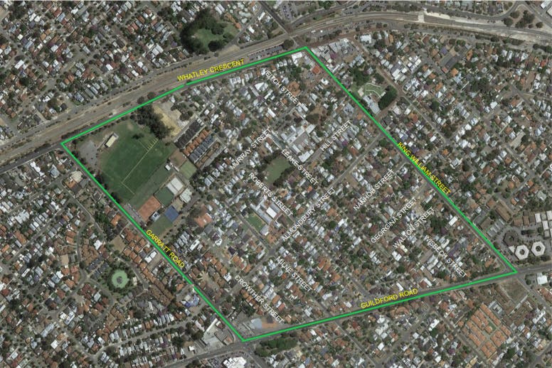
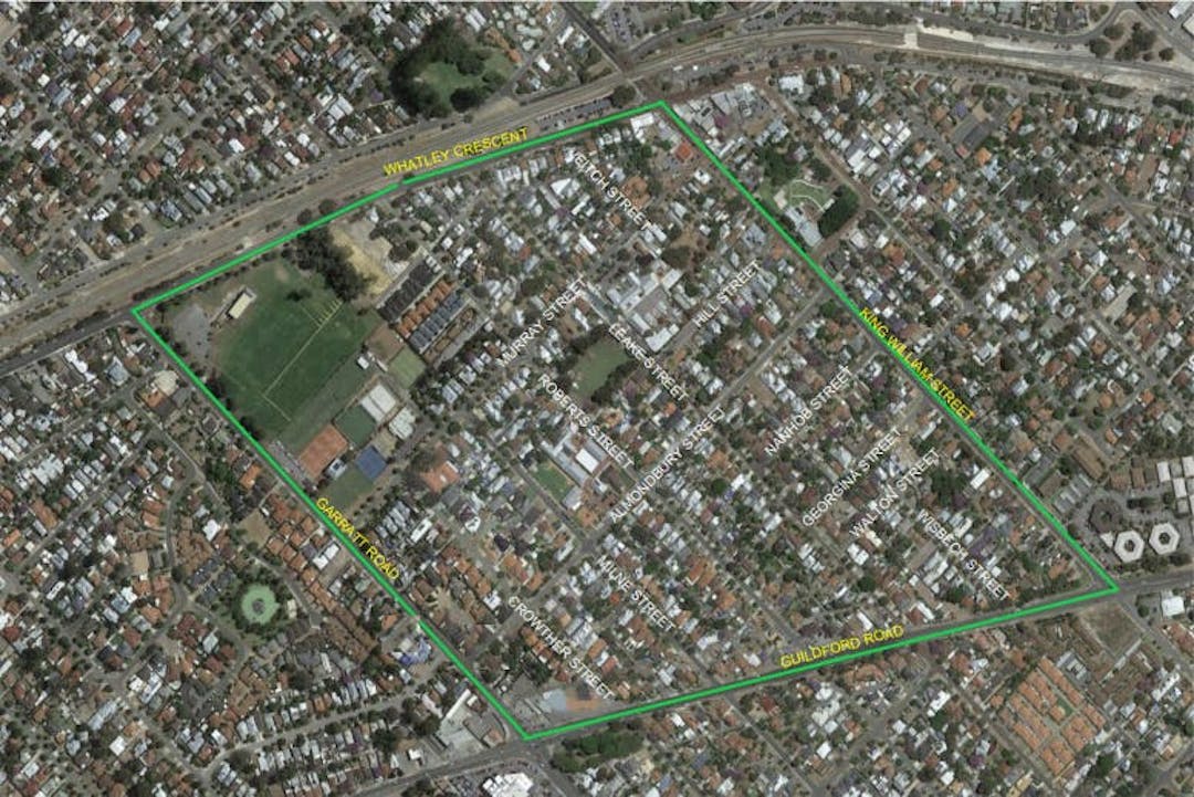
The City has heard ongoing concerns from residents in relation to traffic management in the area of Bayswater (Frank Drago Area) bounded by King William St, Guildford Rd, Garratt Rd and Whatley Cres. These concerns mainly relate to safety, traffic volume and speed, as well as rat-running through the area.

In recognition of the growing level of concern from residents, including a petition to cul-de-sac Leake Street (Whatley Cres end), Council resolved at its Ordinary Meeting of 23 November 2021 to develop a traffic management plan for the area. You can view the full report here (page 277).

With funding from Main Roads WA (MRWA) under the Urban Road Safety Program, the City will develop a plan that will include treatments to tackle issues concerning residents. Examples of the types of treatments that can be used to provide local area traffic management are shown in the fact sheet.

As well as input from local residents, this project will consider findings from the 2017 Local Area Traffic Management study and other relevant information.

Community Engagement 

Input from residents is critical in the development of the traffic management plan. We asked residents to get involved in December 2021 by attending a drop in session and/or using the online map below to let us know what they're observing. You can view community input received online in the map below. A summary of the data is provided in the Stage 1 Outcomes Report. Following a review of submissions, draft traffic management plans were developed by a design consultant engaged by the City.

We then invited residents to comment on the proposed treatments. Community input for this submission period closed March 2022. Reponses have been sent to those residents who provided comments.

Council approved the program at its Ordinary Council Meeting June 28. Minutes are available here (Item 10.3.1, on page 237).

What Happens Next?

The project has now moved to the construction phase, residents with a treatment adjacent to their property have been notified and we are ready to proceed. To enable the works to proceed smoothly there will be road closures in place at various times, however there will be traffic controllers on site at all times to assist motorists. The works will be limited to the road surface only and will not affect crossovers or verges.

Works in this precinct will commence on 21 February 2023 and be constructed in 2 stages to avoid conflict with the temporary part closure of Whatley Crescent for rail works. The City now expects the works in this precinct to be complete by June 2023

Bayswater precinct map

about 2 years

Use the map of the Bayswater precinct to provide your feedback on locations where you have experienced the following:

- excessive speed

- high volumes of vehicles

- rat-running

- other (please state)

From the icons on the left of the screen, select the pin you wish to use, and then drag and drop it on the relevant location on the map.

In the first comment box, tell us what you are observing. Then complete the other short questions.

*Please note that you need to be registered on Engage Bayswater to participate in this activity. You will be taken to the sign in page where you can enter your log in details, or click on Register.

CLOSED: This map consultation has concluded.